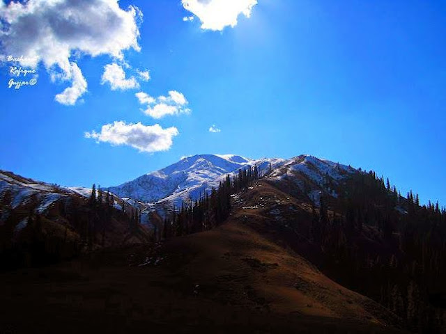
"Visited so many places of historical and tourist interest. But the visit which has a lasting impression on my mind is the visit of Kashmir. It is the most beautiful place I have ever seen. It is said to be the heaven on earth. It has the accolade of being “The Switzerland of Pakistan AJK/Occupied Kashmir”. I was wonderstruck to see the ravishing beauty of Kashmir. With snow-clad mountains, tall-trees of deodar/ Chinar, lush green plains and valleys, Kashmir is one of the most bewitching places on earth. It has been a great attraction for the tourists all across the country and abroad as well.

"The Northern Areas like Kashmir Gilgit Baltistan and FATA where the Villages Located in far flung Areas lacking the basic amenities of life like roads health,educations,electricity,being distant from grids still depend on day light to Start and Stop their Life Activities. The Present Power Crisis in Pakistan has Further Dimmed the Chances to avail common human life requirements in Remote Area''

''The only solution to overcome power crisis/facilities in the remote areas is to exploit the available resources like natural waterfalls by installing small hydel projects and by the insertion of solarpower technology''

The sunshine picturesqueness view below depicting paradise is self explanatory, but due to lack of above mentioned facilities the tourism industry cannot flourish unless above sources are fully exploited .

The Kashmir called the paradise on earth has a unique historical background as it was one of 650 states run by princes before partition. The partition of the Indian sub-continent by the formation of India and Pakistan the princes were given liberty to join either of two countries with the consensusof public opinion.Maraja Hari singh wanted like other princes to run state independently but could not succeeded as the publicmass being Muslim opt for Pakistan.Maharaja appealed to indian Govt for military assisstance to control state by force but his hopes of renamingindependence were diminished as in oct 1947,Pakistan sent tribes who knocked at the premisis of Srinager.

Indian and Pakistani forces thus fought their first war over Kashmir in 1947-48. India referred the dispute to the United Nations on ist January. In a resolution dated August 13, 1948, the UN asked Pakistan to remove its troops, after which India was also to withdraw the bulk of its forces.

Saturday, November 24, 2012

BAGH


Bagh District is one of the eight districts of Azad Jammu and Kashmir, Pakistan. The district, which had been part of Poonch District, was created in 1988. The district is bounded by Muzaffarabad District to the north, Poonch district to the south, and Poonch District of the Indian-administered Jammu and Kashmir to the east; it is bounded by the Punjab, Rawalpindi District and Abbottabad District of Pakistan's North-West Frontier Province to the west. The total area of the district is 1,368 square kilometers. Bagh District is linked to Muzaffarabad by two roads, one via Sudhan Gali (80 km) and the other through Kohala (97 km). It is situated 46 km from Rawalakot. Bagh District was created with three sub-divisions, namely Dhirkot, Bagh and Haveli, with its headquarters at Bagh. It is said that a bagh (garden) was set up by the landowner where the premises of the Forest Department are now located. As a result, the area that is now the district headquarters was named “Bagh”.


Birpani Village
Birpani(بیرپانی) is a town and Union Council in Bagh District, Azad Kashmir, Pakistan. It is located 20 km west of Bagh city and at an altitude of 2000 metres. The origin of the word Birpani comes from the Pahari word Beer and means Veer (Brother/بھائی ).


Sudhan Gali

Sudhengali, located at a height of 2143 meters, links Chikkar with Bagh, a town in the Bagh district. This scenic spot also serves as a base camp for those interested in hiking/ rekking to the nearby 3045 meters high mountain “Ganga Choti”. It is also linked with Chikkar. Busses & vans ply daily from Bahg, Chikkar & Muzaffarabad to this place. A tourist rest house & PWD rest house provide reasonable accommodation facilities here.

Ganga Choti

Ganga Choti is approachable from Sudhan Gali, Dist Bagh, it is four hours trek and it is strenous trek since you have to gain hight at every step, there is very rare flat grounds on this trek. Ganga Choti is a scenic peak village Bani Minhasan in Bagh District, Azad Kashmir, Pakistan. It is 10200 feet high. It is an attraction for tourists in that area. It is situated in the Pir Panjal Range.

Ganga Choti start of spring season

Ganga Choti is approachable from Sudhan Gali, Dist Bagh, it is four hours trek and it is strenous trek since you have to gain hight at every step, there is very rare flat grounds on this trek. Ganga Choti is a scenic peak village Bani Minhasan in Bagh District, Azad Kashmir, Pakistan. It is 10200 feet high. It is an attraction for tourists in that area. It is situated in the Pir Panjal Range.

Sudhan Gali in winter

Sudhengali, located at a height of 2143 meters, links Chikkar with Bagh, a town in the Bagh district. This scenic spot also serves as a base camp for those interested in hiking/ rekking to the nearby 3045 meters high mountain “Ganga Choti”. It is also linked with Chikkar. Busses & vans ply daily from Bahg, Chikkar & Muzaffarabad to this place. A tourist rest house & PWD rest house provide reasonable accommodation facilities here.

Sudhan Gali Resthouse
BENAZIR PALACE

Sudhan Gali is a village located in Bagh District, Azad Kashmir. It lies on the main road that connects the district Bagh to Muzaffarabad, the capital of Azad Kashmir and also connects the town of Chikkar with Bagh city. Sudhan Gali is located at the height of 7000 feet. This beautiful, scenic place attracts hundreds of tourists from all over Azad Kashmir and Pakistan.
We have established a beautiful Guest house (Benazir Palace) for tourists, which are constructed very beautifully and attract large number of people each summer however, Sudhan Gali is famous for its hiking trails that lead to Ganga Choti (Peak), a mountain peak about 10200 feet high and one of the most famous tourist attractions in Azad Kashmir.
Sudhan Gali is also home to some of the rarest forests in the region containing pine trees that are hundreds of years old.


Poonch AJK

Rawalakot City

Location

Rawalakot is located at Latitude 33°51'32.18"N, Longitude 73° 45'34.93"E and an Elevation of 5374 feet. Rawalakot is approximately 76 kilometres (47 mi) from Kohala, Pakistan and about 120 km (75 mi) from the city ofRawalpindi. It is linked with Rawalpindi and Islamabad via Goyain Nala and Tain roads. Via Kotli Satiyan and Kahuta.It is also linked with Rawalpindi via Sudhnuti.

Tourism

Banjosa and Toli pir two popular tourism destination in Azad Kashmir are in this area. Rawalakot Airport situated in Chak Dhamni has great attraction for tourist. Lodges, government-owned and private guest houses, and hotels are available in different parts of Rawalakot. Attractions include: mountain-based adventure tourism, rock climbingmountaineeringtrekking, summer camping and hiking, water-based adventure tourism, and paragliding.

Banjosa


Banjosa Lake is an artificial lake and a tourist attraction 20 kilometers (12 mi) from the city of Rawalakot in District Poonch in Azad Kashmir, Pakistan. It is located at an altitude of 1,981 meters (6,499 ft).
The lake is surrounded by densely pine forest and mountains, which make its very charming and romantic. The weather in this area remains cool and pleasant in summers, and cold and chilly in Winter. In December and January snowfall also occurs there.
The Banjosa Lake is accessible by a metallic road from Rawalakot. Some rest houses and huts of AJK Tourism & Archaeology Department, Pakistan Public Works Department and Pearl Development Authority are located there for stay. Few hotels, guest houses and tuck shops are also exists there.


                                                                  TOLI PIR
Tolipir photographed from different angles

Tolipir is the highest mountainous location and the most attractive point in the north-eastern area of Rawalakot. Tolipir offers outback time on wide spread grassy fields and aspiring views as it is the origin point of three different mountainous ridges. The tourism rest-house on the way to tolipir is also located on a very scenic location. There are some old remains of a Mazaar at the highest top of Tolipir. Weather is pleasant in summer and snowfall in winter

Tolipir
Seasonal Station of local Residentials


Tolipir


Gulf Palace Hotel

Main Khaigala Town Rawalakot


Gulf Palace Hotel Rawalakot is one of best hotels in Azad Kashmir, Pakistan. It is located at about 11 KMs from Rawalakot, 117 Kilometers from Islamabad, 148 kilometers from Muzaffarabad, 100 Kilometers from Kotli,only six Kilometers from famous Banjosa Natural Lake. Hotel offers delicious Pakistani meals at its Restaurant with professional staff, and also has an open air B.B.Q, Room Service, Gift Shop, International Lift System, Internet Facility, Parking Marraige Hall, Conference Hall, Best View, Best Security System, Outdoor Cattering Services,Varriety of Lunch Boxes,24 hrs services, laundary, rent a car, sports facility and other menities


MOhiuddin Uniersity


MUZAFFARABAD


Muzaffarabad is the capital of Azad Kashmir, Pakistan. It is located in Muzaffarabad District on the banks of the Jhelum and Neelum rivers. The district is bounded by Khyber-Pakhtunkhwa in the west, by the Kupwara and Baramulla districts of Indian-held Kashmir in the east, and the Neelum District of Azad Kashmir in the north. According to the 1998 Census, the population of the district was 725,000, and according to a 1999 projection, the population had risen to almost 741,000. The district comprises three tehsils, and the city of Muzaffarabad serves as the cultural, legislative and financial capital of what is presently known as Azad Kashmir.

•Azad Jammu and Kashmir Assembly
•Azad Jammu and Kashmir Supreme Court
•Mosque Assembly Secretariat
•Kh. Khurshid Tomb
•Chehla Bridge
•Subri (Langarpura) Lake
The district is administratively subdivided into three tehsils, these are:[citation needed]
•Athmukam
•Hattian Bala Land of Hazarat Hafiz Jamal u Din."a great saint of his time"
BaniHafiz a Popular village of Hattian Bala. It includ the Mizar of HAfiz Jamal u Din. SAjada nasheen Muhammad Ajmal Irfan Danish.Atrue follower of Jamalu Din


LEGISLATIVE ASSEMBLY BUILDING IN MUZAFFARABAD


Azad Jammu and Kashmir  abbreviated AJK or, for short, Azad Kashmir is a self-governing territory controlled by Pakistan, it lays west of Indian controlled Jammu and Kashmir. It was part of the former princely state of Jammu and Kashmir, which ceased to exist as a result of the first Kashmir war in 1947, fought between India and Pakistan.
It shares border with Gilgit Baltistan, which along with itself is referred by United Nations as "Pakistani-controlled Kashmir". Azad Jammu and Kashmir borders the Indian-controlled state of Jammu and Kashmir to the east (separated from it by the Line of Control), Pakistan's Khyber Pakhtunkhwa Province to the west and Pakistan's Punjab Province to the south. With its capital at Muzaffarabad, Azad Jammu and Kashmir covers an area of 13,297 square kilometres (5,134 sq mi) and has an estimated population of about four million.
The centre of one of the worlds largest disputes, Azad Kashmir has a parliamentary form of Government. The president is the constitutional head of the state, while the prime minister, supported by a Council of Ministers, is the chief executive. Azad Jammu and Kashmir Legislative Assembly elects both the prime minister and president. The state has its own Supreme Court and a High Court. The Ministry of Kashmir affairs serves as a link between theGovernment of Pakistan and the Government of Azad Jammu and Kashmir.[4]
The 2005 earthquake left the region in unparalleled devastation, including 3 million people were displaced and 100,000 deaths. Since then with help from Islamabad and foreign donors reconstruction of infrastructure is underway. Currently, its economy largely depends on agricultureservicestourism and remittances sent each year by members of the large Kashmiri diaspora. There are approximately 1880 hospital beds, the total number of doctors, including administrative doctors, health managers snf dentists is 702. Azad Kashmir's literacy rate is well 64%. At present the gross enrolment rate at primary level is 95% for boys and 88% for girls (between the age of 5-9).[5]

SUPREME COURT BUILDING IN MUZAFFARABAD. 

Supreme Court AJK
The district is bounded by Khyber-Pakhtunkhwa in the west, by the Kupwara and Baramulla districts of Indian-held Kashmir in the east, and the Neelum District of Azad Kashmir in the north. According to ... Supreme Court AJK ...


MUZAFFAR ABAD CITY VIEW
Muzaffarabad city situated on the banks of the Jhelum and Neelum rivers. The district is bounded by Khyber-Pakhtunkhwa in the west, by the Kupwara and Baramulla districts of Indian-held Kashmir in the east, and the Neelum District of Azad Kashmir in the north.
PIR CHINASI  
A 30 kilometers eastward journey from Muzaffarabad takes one to the breathtaking location Pir Chinasi, it is situated at the height of 9,500 feet. Due to its marvelous charming beauty, lush green plateaus and magnificent weather, it wins the hearts of nature lovers. The view of the peak of the neighboring mountain peaks spell bounds a visitor. Devotees of Saint Shah Hussain Bukhari, take pilgrimage to refresh their dust heart. The neighboring Pir Asimar, Phawna Da Danna and the areas in the bottom of Pir Chinasi, i.e. Saran, Sud Bun, Mushki, Sakki and Jarran Phirran are also worth seeing and perfect for hiking, trekking and camping activities. A Tourist Lodge at Saran provides lodging services to the tourists. A visit to Pir Chinasi will convey the visitors breathtaking views of the Jhelum Valley and the magnificent snow-covered mountains. One can get to view several trekking trails and paths amidst a scenic setting. It is a beloved spot for the trekkers and the tourists with a daring bent of mind. A trekking knowledge will surely add a special taste to the entire journey. - See more at: http://www.tourisminpakistan.com/azad-kashmir/muzaffarabad/pir-chinasi/#sthash.RjyEiLNG.dpuf
EVENING VIEW OF MUZAFFARABAD CITY
FAMOUS SITES LOCATED IN MUZAFFARABAD
•Azad Jammu and Kashmir Supreme Court
•Mosque Assembly Secretariat
•Kh. Khurshid Tomb
•Chehla Bridge
•Subri (Langarpura) Lake
The district is administratively subdivided into three tehsils, these are:[citation needed]
•Athmukam
•Hattian Bala Land of Hazarat Hafiz Jamal u Din."a great saint of his time"
BaniHafiz a Popular village of Hattian Bala. It includ the Mizar of HAfiz Jamal u Din. SAjada nasheen Muhammad Ajmal Irfan Danish.Atrue follower of Jamalu Din

Muzzafarabad Qila Bridge Gate way to Neelum valley. The Neelum river is the outcome of spring water  starting from Shounter pass and junctioning with Jahlum river coming from Srinagar at Domail.

INTERCON HOTEL IN CHATTAR DOMAIL
The Pearl Continental Hotel, Muzaffarabad is situated on the tranquil core and vantage speck of the metropolitan bordering rivers of Neelum and Jhelum with panoramic manifestation of Pirchinassi and uptown stack array.
Muzaffarabad is an easy 2 hours’ drive from Abbottabad via Mansehra route (70 km) and from Benazir Bhutto International Airport is at a distance of 138 km (3 & half hours’ drive). Usually from Islamabad, the route via Murree is used to reach Muzaffarabad.


Destination - Travel Guide
Muzaffarabad, deemed as ‘a paradise on earth’, is located on the confluence of the Jhelum and Neelum rivers with luxuriant landscapes. The valley is renowned for its retreats, resorts, lofty mountains and the lush green forests of Chinar, Deodar and Pine trees. The tourists and nature lovers are enamored with its exuberance and abounding flora and fauna.
The Pearl Continental Hotel, Muzaffarabad is situated on the tranquil core and vantage speck of the metropolitan bordering rivers of Neelum and Jhelum with panoramic manifestation of Pirchinassi and uptown stack array.
Muzaffarabad is an easy 2 hours’ drive from Abbottabad via Mansehra route (70 km) and from Benazir Bhutto International Airport is at a distance of 138 km (3 & half hours’ drive). Usually from Islamabad, the route via Murree is used to reach Muzaffarabad.
Springs of cold & fresh water gush out of hillside where one can comfort the difference in the temperature. From Islamabad, the road winds down to the Jhelum River at Kohala, where one can cross the river into AJ&K. Turn left and follow the Jhelum River upstream for 35 Km to Muzaffarabad.

PLACES OF INTEREST (attractions & landmarks)

Muzaffarabad City Tour
Red fort, Madina Market at 15 minutes’ drive from the hotel.

Pir Chinasi
Admired by nature lovers for its scenic beauty and pleasing climate at 9,800 ft, approximate travel time-one hour and thirty minutes from Muzaffarabad (30 KM).

NEELUM VALLEY:

Patika
Gateway to Neelum valley, located at a distance of 19 KM, approximate travel time- 40 minutes from Muzaffarabad.

Authmaqam 
Beautiful valley at a distance of 85 KM from Muzaffarabad. Approximate travel time-02 hours and 30 minutes from Muzaffarabad.

Kutton- Jagran Valley
Also known as Jagran valley is lush green land spread within a radius of 90 KM, approximate travel time- 03 hours from Muzaffarabad.

Keran 
A place for nature lovers at a distance of 93 KM from Muzaffarabad. Approximate travel time-04 hours.

Sharda
Most beautiful spot in the Neelum valley at an altitude of 6,400 ft. situated at a distance of 136 KM from Muzaffarabad. Approximate travel time-05 hours and 30 minutes.

JHELUM VALLEY:

Ghari Dopatta
Town located on both sides of river Jhelum, Distance is 24 KM. Approximate travel time- 45 minutes.

Zilzal Lake at Chikar
46 KM from Muzaffarabad, it is situated on top of the mountains. Approximate travel time- 02 hours.

Chakothi
55 KM, is a bordering village. Only Domestic tourists can visit this area. Approximate travel time-01 hour and 30 minutes.

Patika
Located at a distance of 19 Km from Muzaffarabad, it is a gateway to Neelum valley and can be the first journey break on the way.


Kutton

Uphill road from Kundal Shahi leads to Kuttonat a distance of 6 kilometers. The picturesque Kutton and Jagran is best to visit during April to October.


Sharda


The most picturesque place in Neelum Valley is “ Sharda” it is located at a distance of 136 Km from Muzaffarabad and 30 Km from Dowarian. It is a breath taking spot.
 This beautiful spot in the Neelum valley at an altitude of 6,400 ft. . Approximate travel time-05 hours and 30 minutes from Muzaffarabad.
Arang Kel a beautiful tourist spot in the Neelum valley Muzaffarabad AJK

Arang Kel: - is situated at the hill top near Kel, about 1500 feet ascend from River Neelam. It is also a village full of beautiful sceneries. Beyond this mountain, the next mountain is a part of Indian occupied Kashmir. It is a piece of utmost beauty, one can find in Kashmir. Visit Neelum Valley for Arang Kel.


SARDARI/Halmat: The border village about 49 kilometers ahead of Kel is a fascinating but unexplored sight. The area from Kel to Taobat is called the Halmat. Janawai, Sardari and Halmat are the most beautiful places of this area. The drive itself is slow as the road is a dirt track, crossing streams andwaterfalls. It almost takes 3 hours to reach this place from Kel. You can also start seeing some glaciers melting into the Neelum River.
TAOBUTT
Taobutt

The village about 38 km ahead of Kel, is a fascination with unexplored. Halmat, Tao Butt, Janawai, and Sardari are the most beautiful places around here.
Height 7030ft and 154km from
Muzaffarabad


Wednesday, November 14, 2012

Srinagar 
SRINAGAR
Nagin and Dal Lake
Dal and Nagin Lakes are fed by natural springs. The waters in the Dal and Nagin lake are transparent. But, due to overuse of the Dal lake over the years for growing of vegetables, tourism and other purposes, its size has been reduced to almost half. Nowadays, the government is trying to clean the lake. The various houseboats are located along the banks of the Nagin and Dal Lake. Nagin Lake is clean and provides quiet solitude to tourists. The vegetable market is also located on the Dal and Nagin
Nagin Lake Srinagar
lake, only a short shikara ride away. Early in the morning, the farmers emerge from a maze of floating gardens and canals bringing boat-loads of their produce. They gather in an open waterway to buy, sell or barter their produce. In the morning, the first rays of the dawn tinge the wild gardens of lotus flowers with a delicate pink. The kingfishers can be seen darting about, flashing their wings. As the day breaks, the lakes are alive with other activities. It is a unique world of its own which can not be seen anywhere else.
Srinagar

MUGHAL GARDENS

Mughal Gardens
Nishat, Shalimar and Chashma Shahi are the three famous Mughal gardens which are situated around the Dal Lake. These Mughal gardens are beautifully laid out with fountains and cascading streams and terraced lawns. These Mughal Gardens were the Mughal Emperors' concept of paradise and are today very popular places for picnic and excursion. The Chashma Shahi is the first Mughal Garden which is set into the slopes of its circling hills. This tastefully laid garden commands a magnificent view of the Dal Lake below and surrounding mountain ranges. Chashma
Mughal Gardens Srinagar
Shahi means the Royal Spring and is attributed to Shah Jahan. The original garden was laid out by Shah Jahan in 1632 AD. The Chashma Shahi is named after a natural spring that flows here. The spring waters are believed to have curative and digestive properties. The Pari Mahal is situated nearby which was the Sufi Garden College. Pari Mahal, once a Buddhist monastery and royal observatory, was converted into a School of Astrology by Emperor Shah Jahan’s son, Dara Shikoh. The Pari Mahal has a charmingly laid out garden and is a five minutes drive from Chashma Shahi. The Pari Mahal is situated on the spur of a mountain overlooking the Dal lake, with a well-laid spacious garden in front, and is connected to Cheshmashahi by road. Nishat and Shalimar are very large gardens, located much further down the boulevard. Both these gardens are built on a symmetrical plan of central waterways with fountains dividing a series of garden terraces. Nishat Bagh was designed in 1633 AD by Asaf Khan, brother of Nur Jehan. Nishat is the larger of the two gardens and has an impressive plantation of Chenar trees on its highest terrace. The trees were planted during the Mughal period perhaps by the kings themselves. Nishat Bagh is situated on the banks of the Dal Lake, with the Zabarwan Mountains in its backdrop. This 'garden of bliss' commands a magnificent view of the lake and the snow capped Pir Panjal mountain range which stands far away to the west of the valley. The Shalimar Garden is the most famous garden due to its romantic association with Emperor Jahangir and his lovely queen Noor Jahan. This garden was built by Emperor Jehangir for his wife Nur Jehan. An interesting Sound and Light Show on the love story of the two has been mounted here. The central piece on the upper terrace of Shalimar is the Baradari. It was here that Jahangir relaxed with his beautiful bride surrounded by a million roses and the heady smell of all of them. Shalimar garden is a beautiful garden with sweeping vistas over gardens and lakes, and shallow terraces. The garden is 539 m by 182 m and has four terraces, rising one above the other. A canal lined with polished stones and supplied with water from Harwan runs through the middle of the garden. The fourth terrace is the best terrace, and was once reserved for royal ladies..

Kashmir Houseboat Packages
  
Duration : 3 Nights/ 4 Days
  Destination :  Srinagar - Gulmarg - Srinagar


Day 1 : Srinagar
On arrival Srinagar airport, pick up and transfer to Lalarukh Houseboats. After fresh up shikara ride in Dal Lake. Overnight stay in houseboat.

Day 02: Srinagar Local Sightseeing (50 KMS).
After Breakfast full day Srinagar sightseeing of the Mughal Gardens, Nishat Bagh & Shalimar Bagh. All the gardens are situated on the banks of the Dal lake. and visit to Shankra chariya Temple, and after sightseeing evening back to Houseboat, Dinner and overnight stay in Houseboat.

Day 03 : Srinagar – Gulmarg – Srinagar (112 KMS).
Full day tour of Gulmarg which is one of the most beautiful summer resorts in the valley. It is also popular for its golf course (in summer), the highest in the world and Skiing during the winter season. Enjoy the splendor of nature and the snowy mountains. One can have Gondola ride (cable car) from Gulmarg to Khalinmarg In the evening return to Houseboat. Dinner and overnight stay in Houseboat.

Day 04 : Srinagar DepartureMorning free for personal activities. Afternoon transfer in time to the airport to connect onwards destination flight


Package Includes..

ARRIVAL / DEPARTURE TRANSFER.
SHIKARA RIDE ON DAL LAKE.
FULL DAY SRINAGAR SIGHTSEEING (MUGHAL GARDEN, NISHAT GARDEN, PARI MAHAL, SHANKRACHARIYA TEMPLE etc.
FULL DAY RETURN TRIP OF GULMARG.
MEALS: MAP BASIS ( BREAKFAST & DINNER ).

ALL SIGHTSEEING BY  VEHICLE.
ROAD TAX, FUEL, AND TAXES INCLUDE
Srinagar

Tuesday, October 30, 2012

Beauty of Kashmir

Kundal Shahi

KUNDAL SHAHI

 The village is located 74 kilometers (46 mi) from Muzaffarabad on the bank of Neelam River.
KUTTON

 Also known as Jagran Valley, is a village and tourist resort located 82 kilometers (51 mi) from Muzaffarabad and 8 kilometers (5.0 mi) from Kundal Shahion the bank of Jagran steam. Rest houses of AJK Tourism Department and WAPDA are located here. Some private rest houses and hotels are also available here for tourists stay.
HALMAT

Neelum Valley

Neelum Valley

Neelum Valley

RETTI GALI
is located in Neelam valley at the altitude of 12,130 feet (3,700 m). The lake is accessible from Dowarian by a 19 kilometers (12 mi) hiking trek. Dowarian is the base camp to this lake.

Neelum Valley

NEELUM VALLEY

SHARDA MONUMENT

One of the beautiful spots of the Neelum valley located on the banks of the Neelum river at an altitude of 1,981 meters (6,499 ft), about 136 kilometers (85 mi) from Muzaffarabad.
The ruins of the famous temple and Hindu pilgrimage site Sharada Peeth, dedicated to the goddess Sharada, is situated in this town. Other historical sites in the town include the Sharda fort, and Kishan Ghaati.
Few private hotels and a tourist hostel of AJK Tourism Department located there for tourists stay.
Sharda

DUWARIAN

 It located 106 kilometers (66 mi) from Muzaffarabad and 22 kilometers (14 mi) from Athmuqam on the bank of Neelam River at the altitude of 1,615 meters (5,299 ft). A rest house of AJK Tourism Department located here for tourists stay. It is the base camp to Ratti Gali Lake.
Dowrian

SHARDA REST HOUSE

HALMAT TAOBUTT


ARANG KEL

 A village and tourist spot located on the hill top near Kel at the altitude of 8,379 feet (2,554 m) feet. It is accessible by a 2 kilometers (1.2 mi) trek from Kel.


ARANG KEL
 A village and tourist spot located on the hill top near Kel at the altitude of 8,379 feet (2,554 m) feet. It is accessible by a 2 kilometers (1.2 mi) trek from Kel.


Janawai

Janawai

Janawai

Phulawai


Helmet
SARDARI
Sardari
Taobut